Standalone - no simulator needed

Practise VFR flights without a simulator

Plan a flight between Swiss aerodromes; a simulated aircraft flies it while you fly the radio.

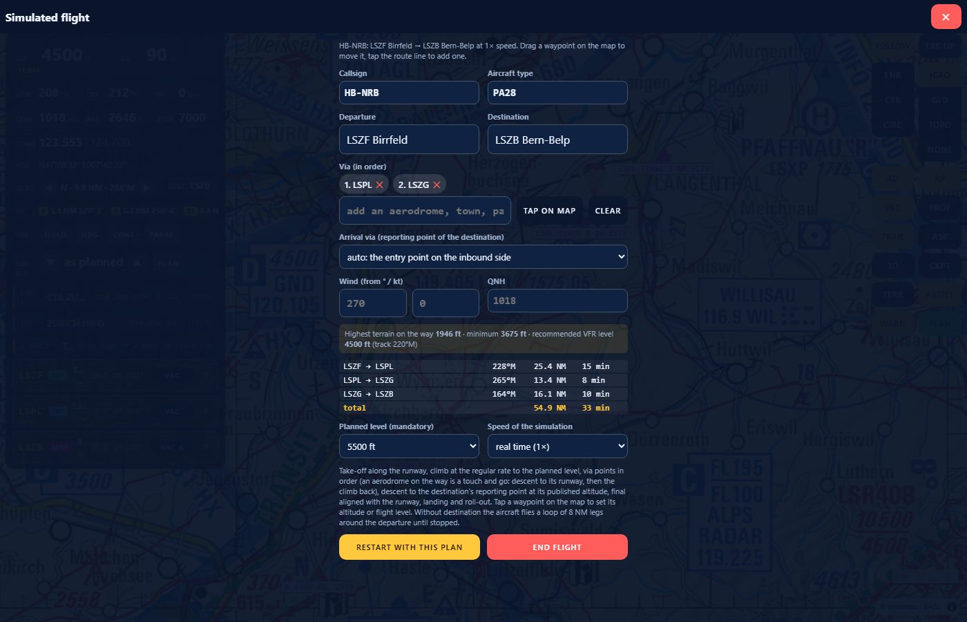
The Simulated flight plan sheet: callsign and type, departure LSZF, destination LSZB, via points LSPL and LSZG, wind, QNH, the terrain and recommended VFR level line, the leg table with bearing, distance and time, planned level 5500 ft
The plan sheet: aerodromes, via points, level, wind and QNH, legs with track and time.

Plan the flight

Choose departure and destination among the 67 Swiss aerodromes, add via points in order (towns, passes, lakes, summits, reporting points, other aerodromes), set the wind and QNH, and pick the planned level. The plan preview shows every leg with magnetic track, distance and time, the highest terrain and the recommended VFR level; a leg that cannot be flown turns red.
The simulated aircraft

Take-off along the runway, climb at the regular rate, via points in order, descent via the destination's reporting point at its published altitude, final aligned with the runway, landing and roll-out. An aerodrome on the way is a touch and go. Fly at 1×, 3× or 10×, PAUSE, HOLD (orbit), HDG (fly a heading), or jump a leg with ◀ ▶.

The pilot page

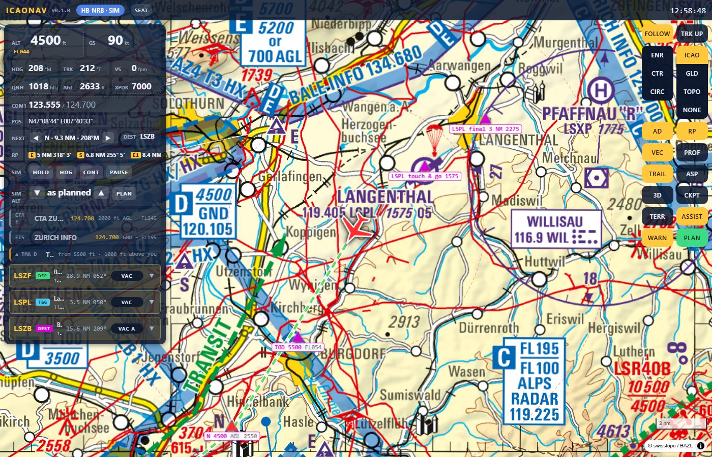
The pilot page in flight on the ICAO chart: instrument panel with ALT, GS, HDG, TRK, VS, QNH, AGL, XPDR and COM1, the next waypoint, reporting points, the airspace rows and the aerodrome rows with VAC buttons
In flight: instruments, airspace chips, the radio call to make.
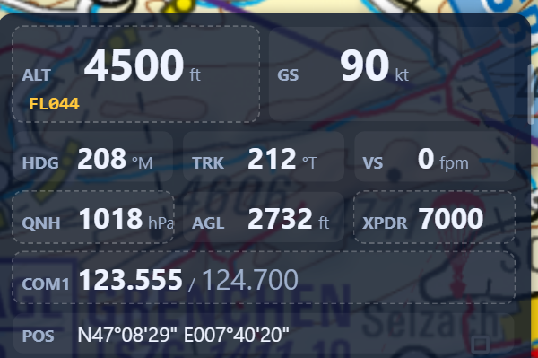
  • Instruments: ALT and flight level, GS, HDG, TRK, VS, QNH with an altimeter subscale (QNH / STD), AGL, XPDR, COM1, next waypoint, destination.
  • Airspace awareness: the airspace you are in with its limits and class, the volumes above and below, a PREPARE / CALL NOW banner before a CTR, TMA or FIZ with the unit and frequency.
  • Radio: COM1 keypad with the units around you, the suggested call built from phraseology templates, CALL MADE and READBACK, clearances and handovers from the controller, traffic information in clock position.
  • Reporting points (RP) as the chart's triangles, with distance, bearing and ETA; VEC track vector and range rings; PROF vertical profile with terrain and airspace limits.
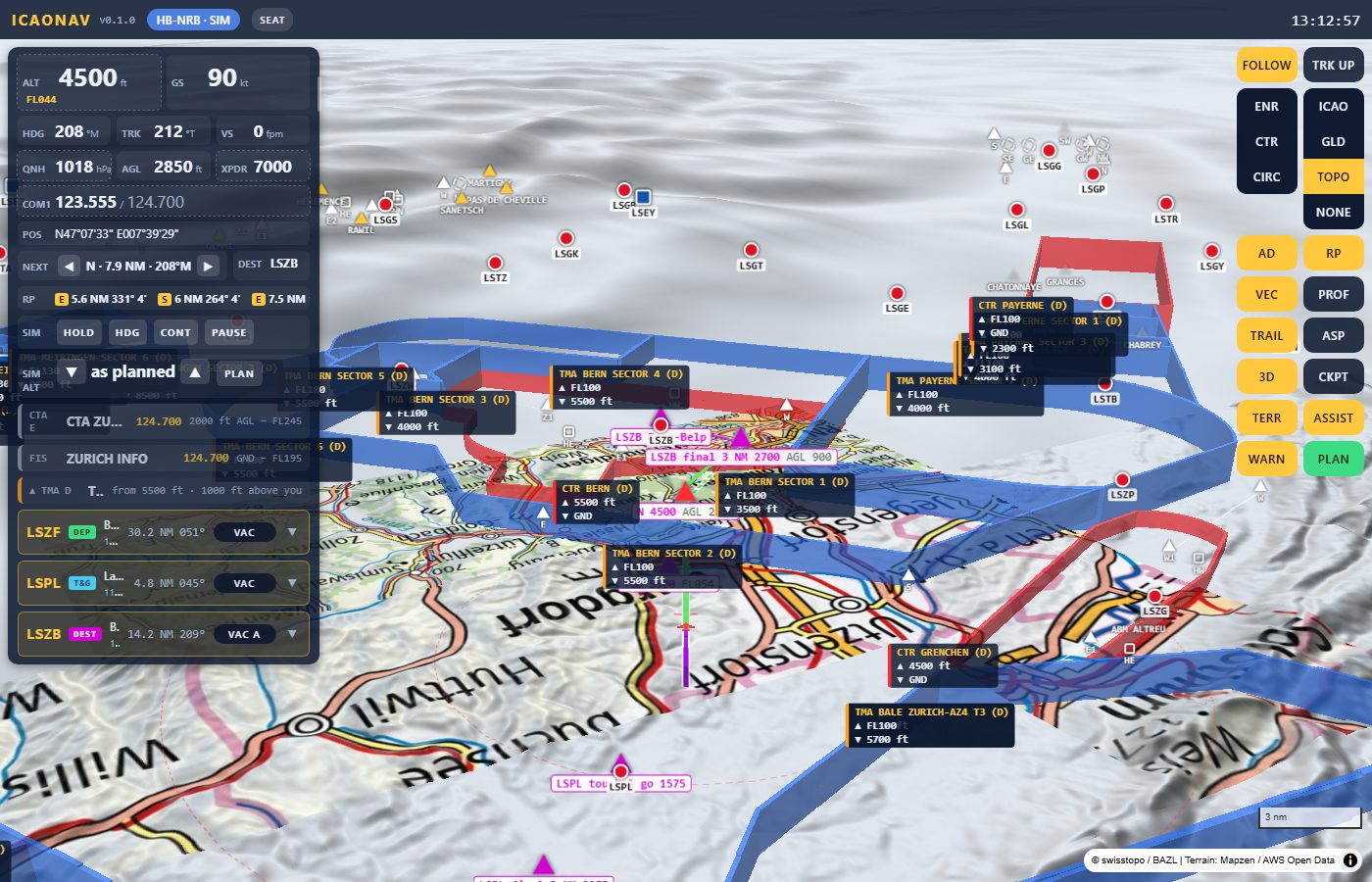
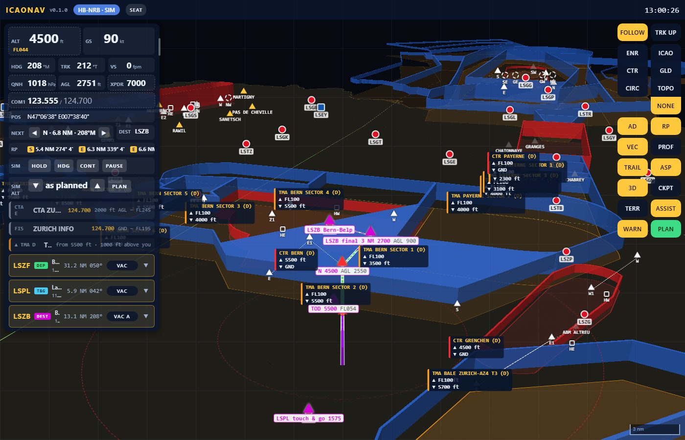
  • Views: 3D chase view with airspaces as volumes, CKPT cockpit view, TERR terrain relief; map modes ICAO, GLD (glider chart), TOPO and NONE (airspaces alone).
  • ASSIST off = chart, instruments, route and documents only, for training on the bare chart.
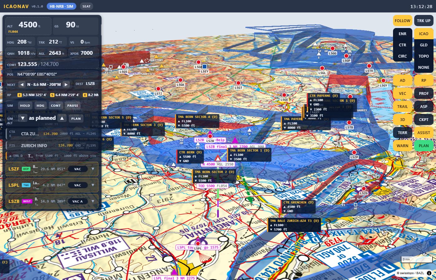
3D chase view behind the aircraft with the ICAO chart and the airspace volumes of CTR Bern, TMA Bern, CTR Grenchen and TMA Payerne with their floor and ceiling labels
3D chase view: airspaces as volumes, the route as a ribbon.
TERR view: the same scene with the 3D relief under the swisstopo map and the airspace volumes
TERR: the chart draped over the relief.
NONE map mode: no chart, only the airspace volumes in 3D on a dark background with their labels, the aerodromes and the route
NONE: the airspaces alone, in 3D.
Close-up of the instrument block: ALT 4500 ft and FL044, GS 90 kt, HDG 208, TRK 212, VS 0, QNH 1018 hPa, AGL 2732 ft, XPDR 7000, COM1 123.555 with standby 124.700, position
The altimeter subscale: QNH of the day or standard 1013.

The controller page

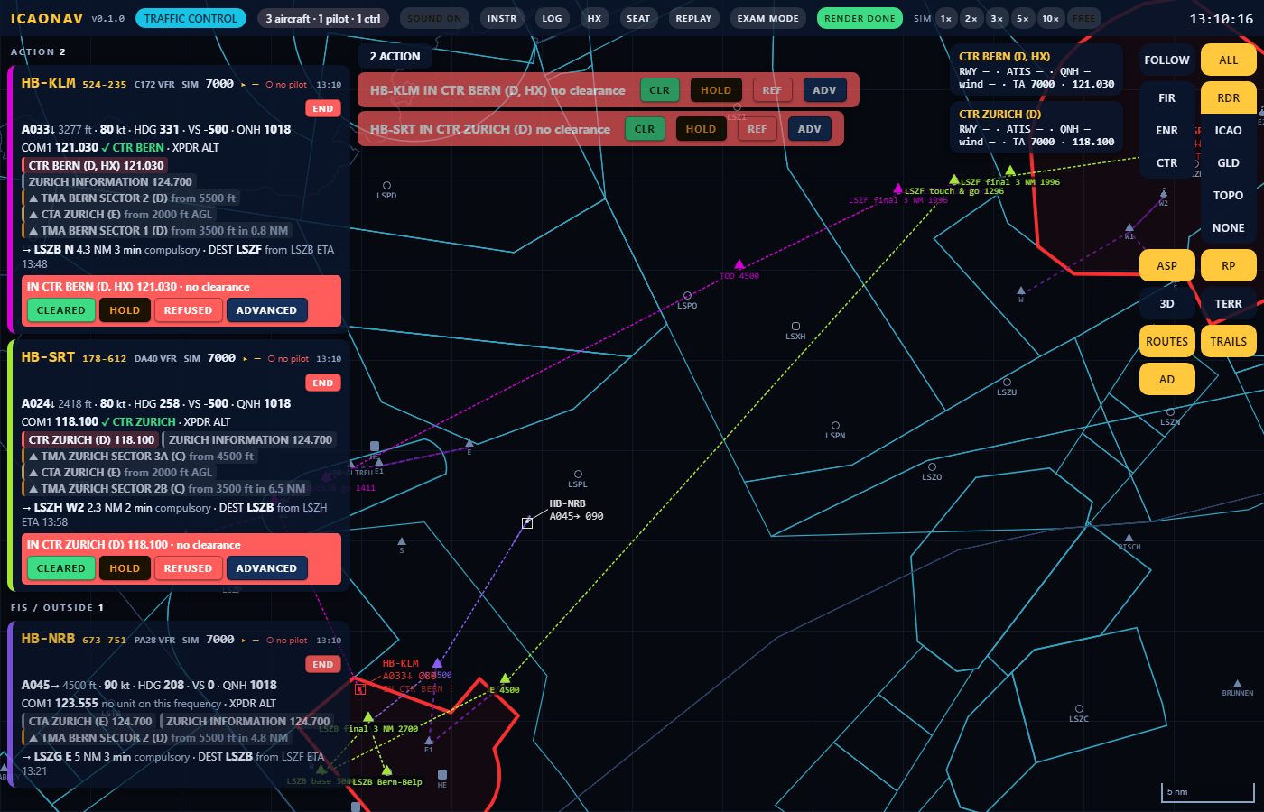
One flight strip per aircraft in ACTION / ACTIVE / FIS bays: type, squawk set and assigned, COM1 with "on frequency", airspace class chips, next reporting point and ETA, clearance on file. Warnings five minutes before an aircraft enters a CTR, TMA or FIZ, traffic alerts, emergency squawks with sound. Quick CLEARED / HOLD / REFUSED, scenario cards (RWY, ATIS, QNH, wind), event log with export. Map modes: RDR radar view (default), ICAO, GLD, TOPO, NONE, 3D and TERR.

The controller page in RDR mode: three flight strips, two in the ACTION bay with the warning in CTR no clearance and the buttons CLEARED, HOLD, REFUSED, ADVANCED; radar symbols with data blocks and airspace outlines
RDR mode: radar symbols, data blocks, airspace outlines.
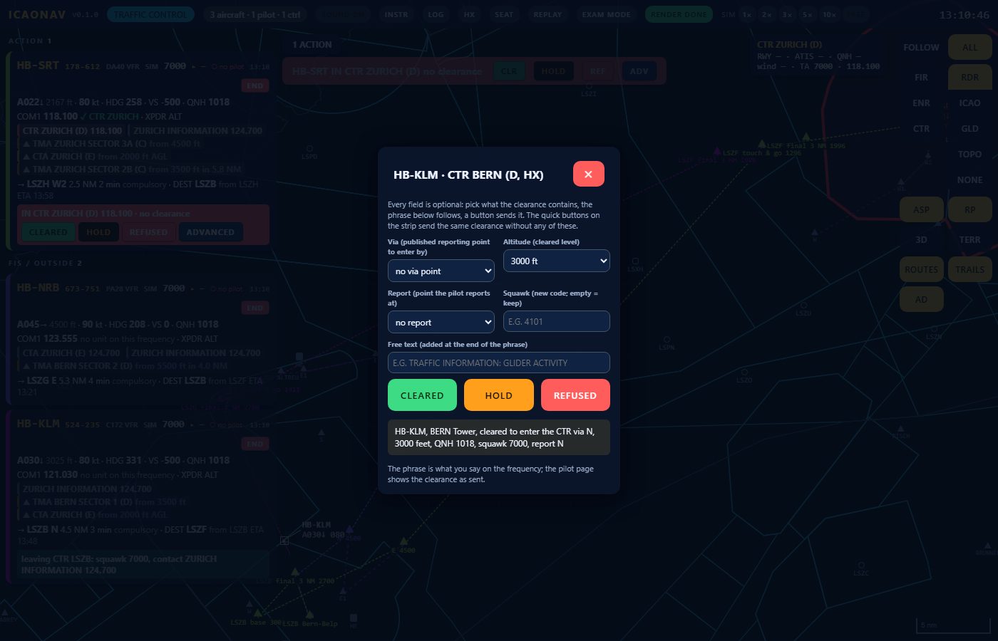
The advanced clearance editor for HB-KLM and CTR Bern: via point, altitude, report point, squawk, free text, the buttons CLEARED, HOLD, REFUSED and the resulting phrase: HB-KLM, Bern Tower, cleared to enter the CTR via N, 3000 feet, QNH 1018, squawk 7000, report N
Quick CLEARED / HOLD / REFUSED on a warning.

Rejoin by flight number

Every flight has a number on its strip, such as 224-204. A pilot whose tab closed, or who changes device, types the number in the seat dialog and continues the same flight.

Talk on any channel

Same room, Discord, a radio: ICAONAV shows what to say and when; it does not carry the audio.

A session on the LAN

  1. Start ICAONAV on the PC; the tray shows the address and a QR code.
  2. Each pilot opens it on an iPad or laptop and takes "Pilot · simulated flight" with a callsign and a plan.
  3. The controller opens the same address and takes "Traffic control".
  4. Talk on any voice channel you like (same room, Discord, a radio): ICAONAV shows what to say and when; it does not carry the audio.

Download ICAONAV 0.6.0 - early access

The file

ICAONAV-0.6.0-win-x64.zip

Download for Windows

Inside: ICAONAV.exe (one self-contained file, no .NET to install), the data folder (aerodrome list, frequencies, reporting points, phraseology, airspace classes) and wwwroot (the pages).

Requirements

Windows 10/11 64-bit; internet on the PC for the map tiles and airspaces (cached afterwards); X-Plane 12.1.1+ or MSFS 2024/2020 for the simulator seats. The eVFR Manual (aerodrome charts) is not included: download it in the app with your own Skybriefing account.

First start

  1. Unzip the folder anywhere, e.g. C:\ICAONAV.
  2. Run ICAONAV.exe. Windows SmartScreen warns because the preview build is not yet signed: "More info" → "Run anyway". Allow ICAONAV through the firewall for private networks when asked.
  3. The tray icon shows the address and a QR code. Open it on the iPad (same Wi-Fi) and take a seat.

Version 0.6.0 is early access; features and files change between builds. The release build will be signed by Swissbix SA. Not for real navigation.